Can drones help us count shorebirds where they matter most?
Intertidal mudflats provide critical feeding habitat for migratory shorebirds, but are difficult to survey using traditional methods. Photo by Arjun Myanger.
For decades, shorebird monitoring has relied on a simple principle: count the birds when they are easy to count.
In Moreton Bay and many other important shorebird sites around the world, this means surveying birds at high-tide roosts, where thousands of individuals gather into relatively compact flocks. These surveys have been enormously valuable, helping to reveal dramatic population declines and underpin major conservation actions across the East Asian–Australasian Flyway.
But shorebirds do not spend most of their time at roosts.
They spend much of their day spread across vast intertidal mudflats, searching for food. Understanding how birds use these feeding areas is essential for conservation, yet surveying birds while they are foraging is far more difficult than counting them at roost sites.
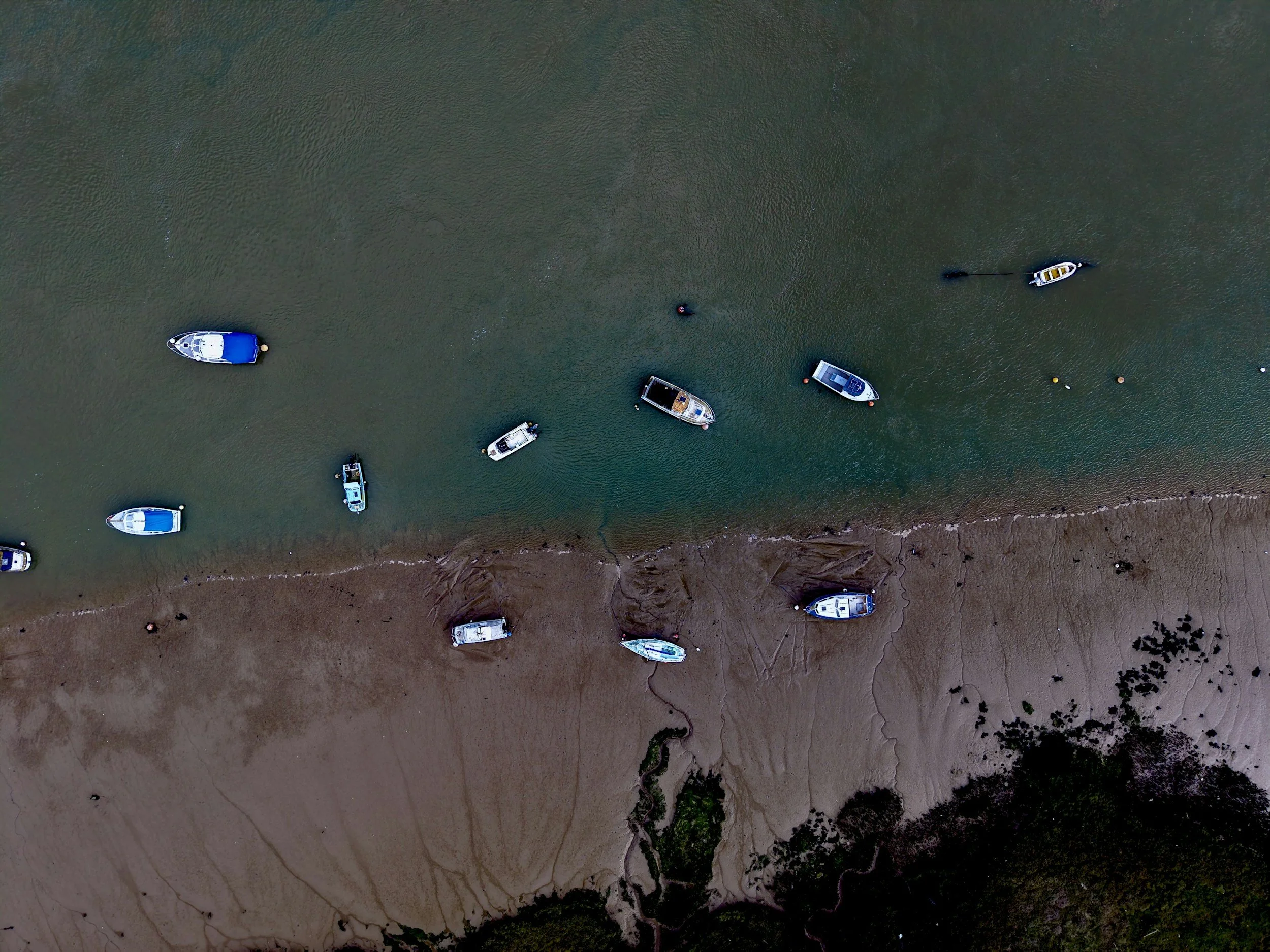
In a new paper published in Emu – Austral Ornithology, Josh Wilson explored whether drones could help solve this problem. The study tested a drone-based survey of birds foraging on an intertidal mudflat in Moreton Bay, providing a proof-of-concept for future monitoring efforts.
The team used a DJI Mavic 3 Enterprise to survey a section of mudflat on Minjerribah (North Stradbroke Island). Flying a series of transects across the mudflat, they captured hundreds of high-resolution images that were subsequently examined both manually and using computer vision tools.
The results were encouraging. The imagery was detailed enough to detect and identify larger waterbirds, while automated image-analysis tools successfully detected most birds present in the survey images. Just as importantly, the drone surveys caused little obvious disturbance to foraging birds when operated at appropriate heights.
The study also highlighted some of the challenges involved. Estimating bird abundance across extensive mudflats requires careful survey design, particularly when only a subset of the habitat can be sampled. In this trial, the spacing between transects proved too wide, leading to substantial error when counts were extrapolated across the entire site. Rather than being a failure, however, this provided valuable lessons about how future surveys should be designed.
The paper provides practical recommendations for researchers wishing to use drones in intertidal environments, including guidance on image resolution, flight planning, disturbance minimisation, and image processing. It also highlights the growing potential of computer vision approaches to assist with processing large volumes of imagery.
For shorebird conservation, the implications are significant. We know a great deal about where birds roost, but often much less about how they use feeding habitats. Better information on foraging distributions could help researchers understand habitat quality, identify key feeding areas, and assess how birds respond to environmental change.
As drone technology continues to improve, surveys that were once impractical may become routine. This study represents an early step towards monitoring shorebirds not just where they rest, but where they make their living.